At the junction of Temperance Hill and Ashover New Road turn right and continue (using the pavement on the left) for about 300 yds before entering the field path on the right. Keep to the path and you will observe Handley Fields Farm on the right – this has a carved stone (not visible from the path) showing 1590 and as you pass the wall you may see on the other side the remains of the well from where water was obtained.
As you walk towards Ogston Reservoir notice the old hedgerows. A rule of thumb calculation of the age of a hedge is that each species in a 30 m stretch is equivalent to 100 years, so if you can count 5 different types of tree or bush then the hedge is 500 years old!
Find a hedge and see what is in it. What life lives in a hedge?
If you would like to see how hedges are laid then the Countryside Rangers at Clay Cross (01246 866960) will show you.
If hedges are left to grow they will grow into stretches of fully grown trees – do look for some of these. Clumps of bluebells can be observed in the fields in spring – this is a sign that the land was originally an old woodland.
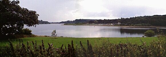
Continue down the path until you come to the stile. Before you cross it observe the attractive view of Ogston Reservoir laid out before you.

The Reservoir covers 200 acres and holds 1300 million gallons of water. The valley was flooded in 1958 to meet the water requirements of the National Coal Board Carbonisation Plant at Wingerworth. At the same time the reservoir provides many leisure activities including sailing, windsurfing and trout fishing. There have been 200 species of bird life recorded at Ogston including Wilson’s phalarope, Sabine’s gull and long-tailed skuas. There are two observation hides used by local bird watchers. You can find out more about bird life on Ogston Reservoir from the Ogston Bird Club
It’s hard to envisage the valley as it was before it was flooded to create Ogston Reservoir. “A Reservoir Takes its Toll“, is an account of life before and after the coming of the reservoir by Mrs Annie Fox.
Care for our birds
In Britain, most wild birds, and their nests, eggs, or chicks, are protected by law from the irresponsible few – but even birdwatchers can harm birds in their enthusiasm! Take care not to disturb the birds you watch, particularly in the nesting season.
Several properties, roadways and part of the Ashover Light railway were submerged in the flooding of the valley. Woolley House was originally a large country house run as a Hydo which took in visitors all year round. Attached to it was a small village store where you could buy anything from a box of matches to a hundredweight of corn. In the yard at the back was the old joiners shop which was used by the local undertaken. Later the house was sold and divided up into six small cottages for local folk but the shop remained and a post office was added. The shop, eleven other cottages and the old public house “Napoleon’s Home” were demolished. Also destroyed was the old sheep wash, the laundry where the washing from Woolley Hydro and Stubbin Edge Hall was done, and a blacksmith’s shop.
The present sailing club building which can be viewed from the field was originally the Amber Valley Camp School. It was built in 1939 to give 250 children from urban areas the benefit of have a months education in rural surroundings. During the war Derby Grammar School was evacuated there.
The boating pool was formed by diverting the stream that ran from Littlemoor – this also worked the corn mill further up the road.
The old sawmill which used to be driven by a water wheel to saw blocks of stone was also a casualty of Ogston.
Most of the inhabitants of Woolley Moor were rehoused in council houses up the hill, which is now the main village area.
If you wish to find more about the building of Ogston Reservoir and its present day function contact:
Severn Trent Water Ltd
North Derbyshire District
43 Dimple Road
Matlock
Derbyshire
DE4 3LQ
Tel: 01629 540696
Severn Trent Water information: “A Site of Special Scientific Interest (SSSI) for its breeding bird communities and access is limited. A new public hide with views across the water and interpretation will be open for the new year 2000. Limited fly fishing is available. For further details contact the rangers on 01629 540696.
There are three car parks, two of which have picnic facilities overlooking the water. Public toilets operated by North East Derbyshire District Council are close by.
Tucked out of the way, this site can be found on the B6014 near Tansley, between Matlock and Clay Cross. ”
Part of the Ashover Light Railway was submerged by creation of reservoir. This was officially opened in 1925 to carry stone from the Ashover Quarries to Clay Cross for the Clay Cross Company. It also provided a public passenger service. The four original steam engines were bought from the war disposals board at a cost of £1000 and were name Hummy, Guy, Joan and Peggy after the children of General Jackson of the Clay Cross Company.
It was originally a great success but after the commencement of a regular bus service the number of passengers declined and eventually after falling demand for stone the quarries closed in 1950 and the official closure of the line came soon after that.
Further information on the Ashover Light Railway can be found in the book “The Ashover Light Railway” by R Gratton and S R Bond.


