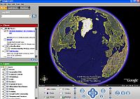
This amazing application allows the user to explore our world using satellite imagery, maps, terrain. Requires broadband to run. Use the measure line or path tool to mark out a route and measure its distance.
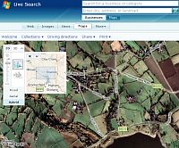
Combines online mapping and satellite images. Annotate images/maps with place markers, routes and coloured in areas. Satellite images (aerial photos?) are often to a higher resolution than that provided by Google Earth, so check out your area.
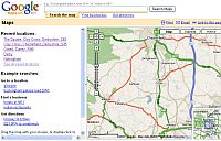
It is easy to zoom in and out and pan around locations using google maps. Can be used to get directions from one place to another. Find out routes to school including distance & time for car journeys, walking and public transport. With a Google account you can make your own maps. Extra icons are available to make your maps more interesting. View maps, satellite images or a hybrid of both.
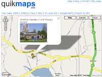
Make your own customised Google Maps with location markers and doodles. Save them and use them in the classroom. Make one for the school web site to show the location of the school for example>>
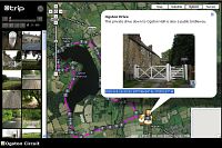
@trip
Make and share your own animated trips complete with photographs. You might use it to record a school trip, a nature walk or a virtual tour.
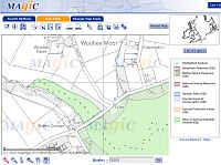
MAGIC is a partnership project involving six government organisations. It provides detailed mapping overlaid with key environmental schemes and interactive GIS tools to query them.
The place to go for detailed mapping.
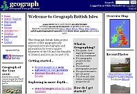
A huge database of geographical representative photographs around the UK and Ireland. The aim of the project is to collect photographs for every square kilometre of the UK and Ireland. Their location is shown on an OS map and images can be sent to be viewed in Google Earth or Google Maps
Ordnance Survey's great new area for schools explaining all you need to know about GIS and its different uses. Includes a teacher zone with lesson plans and a number of GIS Missions involving simulation activities to test out your knowledge of GIS systems.
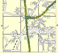
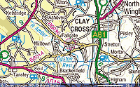
Street level mapping for the UK with searches based on postcode, OS grid reference or place name.
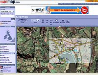
Choice of maps scales down to street level. You can also view aerial photos with a floating transparent map layer - useful for identifying features on the aerial view.
Historical mapping for the UK
1930s England and Wales illustrated with scanned, out of copyright, OS maps from 1925-1945, with the benefit of integration with Google Maps satellite imagery. The transparency of present day overlays can be varied. The site can take a while to load, and not all areas are covered, but it is worth the wait.
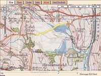
A mosaic of scanned old OS maps, showing what the country looked like during the 1940s.
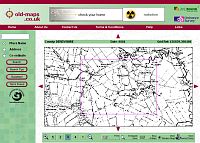
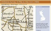
Old maps from around 1900
EasyGPS is the fast and easy way to create, edit, and transfer waypoints, routes, and tracks between your computer and your personal GPS.
GPS Utility is a utility for handling map file. Information from your GPS can be added to any scanned or other digitized map which is calibrated within the program.
Mapyx Quo - free digital mapping software. Some free maps can be used with it and OS map tiles can be purchased quite cheaply through the software interface. You can import and calibration your own map images (eg your school grounds) within the software.